


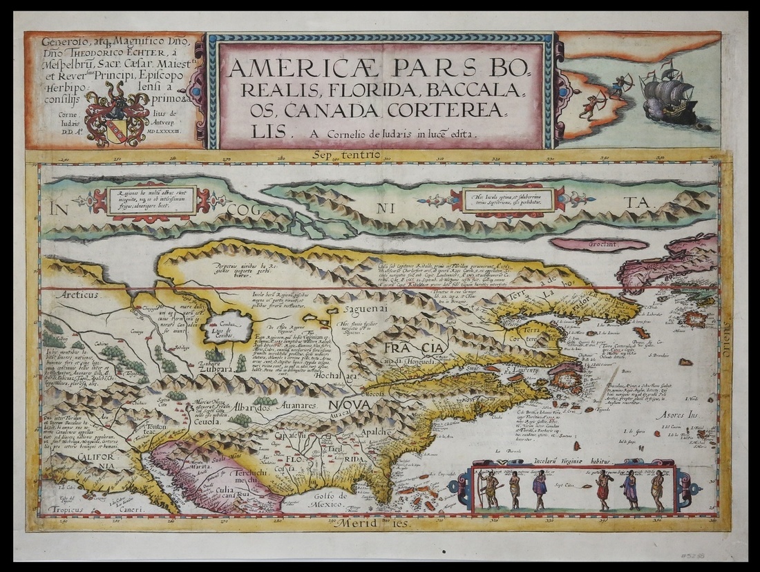
1593年时期地图 近未流通
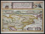
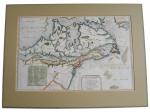
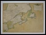
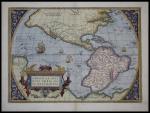
Americae Pars Borealis, Florida, Baccalaos, Canada, Corteralis. Cornelis de Jode. Antwerp, 1593. 19 5/8 x 14", hand color. Latin text on verso. A very nice example of de Jodes rare and highly sought-after seminal work, the first folio-sized map to focus on North America. The depiction of a double Northwest Passage is bold, as is the St. Lawrence coursing across the continent to Texas. Cebola, the seven cities paved in gold, meanwhile, is clearly depicted. The bottom scene showing six native North Americans is derived from John Whites reports, while the attack scene on the upper right is based on Frobisher. The map is studded with annotations regarding early explorations of the New World, and discusses Cabot, Raleigh, Verrazzano and others. An early mention of Apaches is made, as is Lac Conibas, the mythical great lake. The curious contraction and misplacement of the region lying between Maine and Florida is the result of de Jodes combining geographical details from two different primary sources - the French report for maritime Canada and the English report for the Carolinas, both of which containing many inconsistencies. Very Good.
*拍品信息由各家拍卖公司提供,首席数据中心刊载出于传递更多信息之目的,并不意味着赞同其观点或证实其描述。